Laufenburg substation: Modeling terrain and subsoil
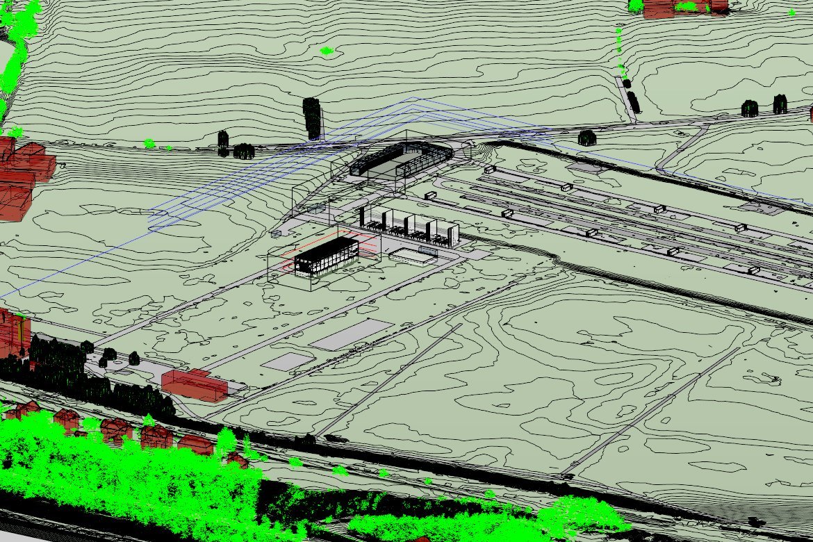
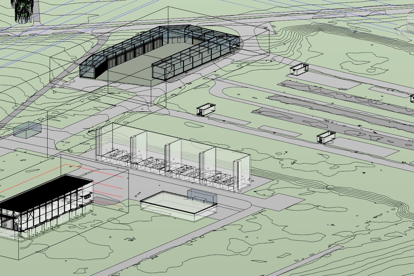
The grid operator Swissgrid is pushing ahead with digitalization. In this context, it wants to create a digital twin of its substation in Laufenburg. We have created a digital model of the terrain and subsurface based on existing survey data.
Are you looking for an experienced partner? We will be happy to advise you.

Swissgrid is having the buildings, transformer stations, lines and underground surveyed and digitally modeled for the digital twin. The perimeter includes the plant itself and a radius of almost 300 meters around it. We processed the point clouds, orthophotos and plans and used them to model the terrain, water, wastewater and electrical lines.
Our services
- Intelligent processing and filtering of point clouds
- Creation of digital terrain models
- BIM consulting
Client
SwissgridIndustry
Energy industry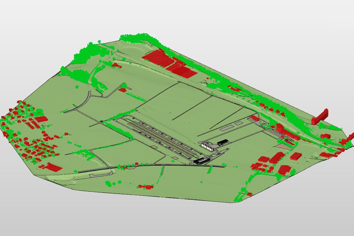
Discover similar projects
By expertise
By industry