Digitization of road drilling and laboratory analyses ZH
The Civil Engineering Office of the Canton of Zurich wanted to digitize its process for condition assessment of cantonal roads using boreholes in order to increase laboratory accuracy. We supported the office in selecting the software and GNSS system as well as creating the interfaces.
Are you looking for an experienced partner? We will be happy to advise you.


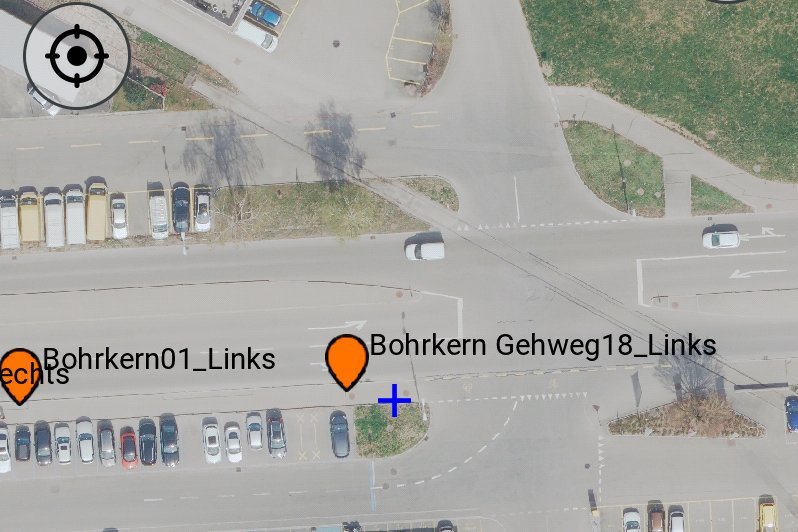
When the canton renovates a section of a cantonal road, boreholes are taken across the entire project perimeter for condition assessment of the various road layers. These are analyzed in the laboratory. The results are incorporated into the detailed planning of the renovation work. We supported the canton's civil engineering office in digitizing this process. The aim was to record the locations of the boreholes measured using GNSS in a database and to enable the laboratories to assign the results of the analyses directly to the corresponding borehole. We advised the civil engineering office on the entire process - from the process design to the choice of software and the creation of the interface between the GNSS system and the database.
Our services
- Process flow consulting
- Software consulting
- Choice of GNSS system
- Integration of the requirements
- GNSS system to database interface
Client
Canton of Zurich, Civil Engineering OfficeIndustry
Confederation / Cantons, Transportation
Discover similar projects
By expertise
By industry