GIS City of Langenthal
Basler & Hofmann set up the basic configuration of the City of Langenthal's geographic information systems and set up the system. The entire GIS infrastructure of the city of Langenthal runs on Basler & Hofmann's servers.
Are you looking for an experienced partner? We will be happy to advise you.


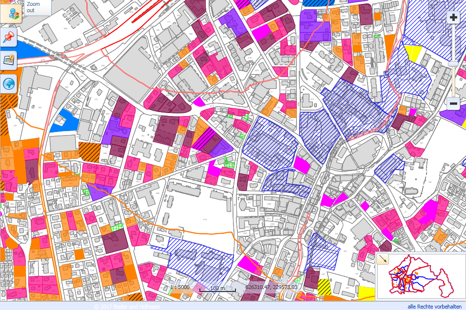
The city of Langenthal has access to the data via a desktop GIS, WebGIS and a mobile GIS. The basic configuration included the transfer and integration of 19 data sets covering numerous topics such as spatial planning, PLR or the settlement guideline plan. Basler & Hofmann created a detailed concept that defined the system specification, the data transfer per topic and the GIS integration process. Following successful system acceptance, system administration was transferred to the city of Langenthal.
Our services
- Setting up the geodata server, including software for recording, maintaining and using the data and the web GIS
- Analysis, transfer and integration of data from various data sources (Oracle DB, CAD data, shape files, Interlis, etc.) into the GIS
- Configuration of the display and functionalities of the GIS
- Setting up and operation of the software environment for data processing by GIS experts from the City of Langenthal as well as a web GIS for the broad use of geodata within the city administration
- LV95 Transformation of all data.
Client
City of LangenthalIndustry
Cities / MunicipalitiesDiscover similar projects
By expertise
By industry